
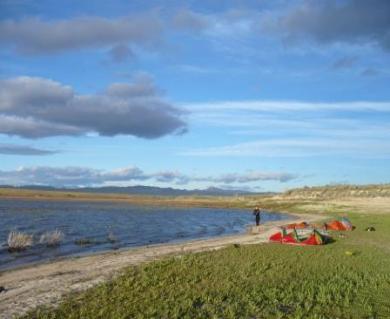
Lucky Peak Res.
Indian Creek Res
CJ Strike Res
Snake River Inlet @ Cj Strike
Lake Lowell
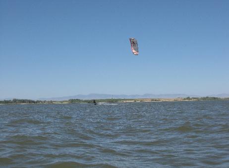
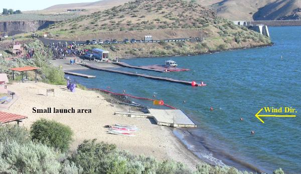
Lucky Peak is the Boise areas most reliable kite spot. However the launch area
is very small, one kite at a time. Shifty onshore winds, docks, and rocky cliff faces
leave little room for error.
Directions: Cross the dam and follow signs to Barclay bay boat ramp. A day use
beach"the launch site" is just to the east. Look for the big Purple serpent.
GPS:43-31-11.67 / 116-03-09.41
Users: advanced kiters only
season: May- Oct
Condition: choppy, deep, clean water
wind: Look for SE or E winds at Boise Airport overnight. This gets the thermal
going. West winds always shuts down the wind at Lucky Peak. On average you
will get 2 good days, 2 okay, 1 crappy, and 2 skunkers out of 7 days.
Note: Watch out for people at boat ramp. You must launch and go straight up
wind. Downwind will put you into the docks, cliffs, and dam.
Indian Creek does not fill up every year. When it does, its an awesome place to kite. Located just 15 minutes from town its our spring spot!
Directions: Take I-84 south from Boise 16 miles, and take Mayfield exit. Head West past truck stop and then take first right on a dirt road. All
Launches are on the south shore.
GPS:43-23-10.91 / 116-00-46.91
Users: Beginner -expert
season: Mar-Jun
Condition: Super flatwater, lily's, algae
wind: Any direction. All frontal winds. Ideal is North. Watch Boise and Mtn Home, then average the two.
Note: Shoreline can be choked with weeds, broken glass and other trash left by shooters. If you tack all the way to the north end be aware of
under water rocky ridges. Always depth check an area before attempting tricks.
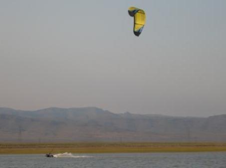
Cj Strike is where many of us local Boise kiters honed are skills way back in the day (03'). Although it can be a good place to kite, its isolation and
lack of near by wind sensors makes it less than ideal.
Directions: Take I-84 south from Boise 20 miles. Take the Simco road exit head south to the grand view hwy. turn right go half mile to Strike dam
cutoff rd. Follow that to the Water.
GPS:42-56-20.19 / 115-57-54.92
Users: Beginner -expert
season: Mar-Nov
Condition: coppy, to small waves. soe near shore is shallow, but mostly deep.
wind: W is ideal. NW gets gusty, and N is even worse. E and SE is good.
Note: For East winds launch at the park North of dam. For all other directions launch from the point 1000ft north of Black Sands Resort. Cj Strike is
known for its gusty swirly wind, crazy storm fronts, and 12ft sturgeon. Some of the launch sites have goat head thorns which kites hate so minimize
the time your kite is on the ground.
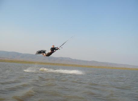
The Snake River Inlet at Cj Strike Res is by far my favorite Idaho spot to kite. Its shallow bays and grassy islands make for sweet flatwater riding. Many
say it reminds them of the Outer Banks of North Carolina which is famous for its shallow water/island.
Directions: Take I-84 south from Boise 40 miles to Mtn Home. Take the first exit head through town to Air Base Road. Then turn South on Hwy 51.
This take you to the Bridge that marks the high water mark of Cj Strike. Launches are on both side of the river. Take your pick they all suck.
GPS:42-56-22.24 / 115-45-13.09
Users: intermediate -expert
season: Mar-Nov
Condition: Shallow to super shallow. Only the main channel is over your head. Super flat water, with a muddy bottom.
Wind: W is ideal. NW gets gusty, and N is even worse. E and SE is good.
Note: What keeps this spot from being world class is gusty to on/off/on winds. Trashed shore lines with broken glass, nails, sticker bushes, and
submerged logs can make launching tricky. However once you're out riding and your figure out where the sweet spots are, you will be stoked!
Lake Lowell at first glance appears to be a perfect place to kite. It can produce some really great days. What plagues it now is threatened access
denial by the fish and wildlife management. To date the access is open. Other issues are that during spring months when the winds are good the
water is so high that there are very few launch option. The shoreline becomes a swamp of trees and thick bushes. Then by late summer the water is
so funky the governments advises you not to get in it.
Directions: Take I-84 West from Boise. Take the Karcher exit, and head west on Hwy 55. Follow that to riverside Dr. A park just before the dam
works for east winds. For West winds go to South Shore Dr and park at access #4.
GPS:43-33-51.28 / 116-43-20.39
Users: intermediate -expert
season: Mar-July
Condition: Shallow near shore. Then choppy with small waves. Clean in spring to funky by July. The bottom is mostly small rocks and mud.
Wind: NW is ideal. E and SE is good.
Note: This lake is appropriately named. It seems that in never really blows there. If Mtn Home is blowing West at 30mph then Boise will be 20mph,
and lake Lowell 14mph. This is not a place to get sucked down wind. It is 7 miles long and more that a mile across. Hiking out can involve a 1/4 swim
through lily's and then a half mile swamp hike through thick bushes. Just like the bayou without gators, but plenty of bugs. Unless you live in the
western treasure valley, its way better to drive to Indian Creek Or Mtn Home.
This seasonal irrigation Reservoir is pretty large when full. Extreme caution should be used when kiting there. The entire shoreline is large sharp lava
towards the dam. Close the gate! West shore and east shore maybe reached by car or truck.
GPS:43-05-05.04 / 115-30-13.15
Users: intermediate -expert
season: Mar-july
Condition: Shallow and rocky! The main body is deep.. Super flat water, with a muddy bottom.
Wind: W is ideal. E and SE is good.
Note: These tends to be a last resort spot. If Indian creek is nasty, LP has not been working, and CJ is too light or far. Finding a clean place to
launch can be tricky. Wear booties or carry them with you. However once you're out riding and your figure out where the sweet spots are, you will be
stoked!
Hot Springs Creek Res

208-794-8641 |
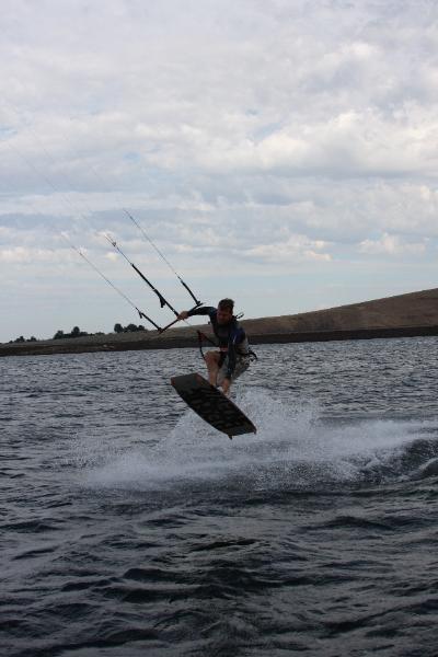
we are a mobile service. Reliability and flexibility is our motto.

Our sister company.
Lucky Peak Res
Instruction, Equipment, Advice!